Driving From London to Singapore: A Technology Guide
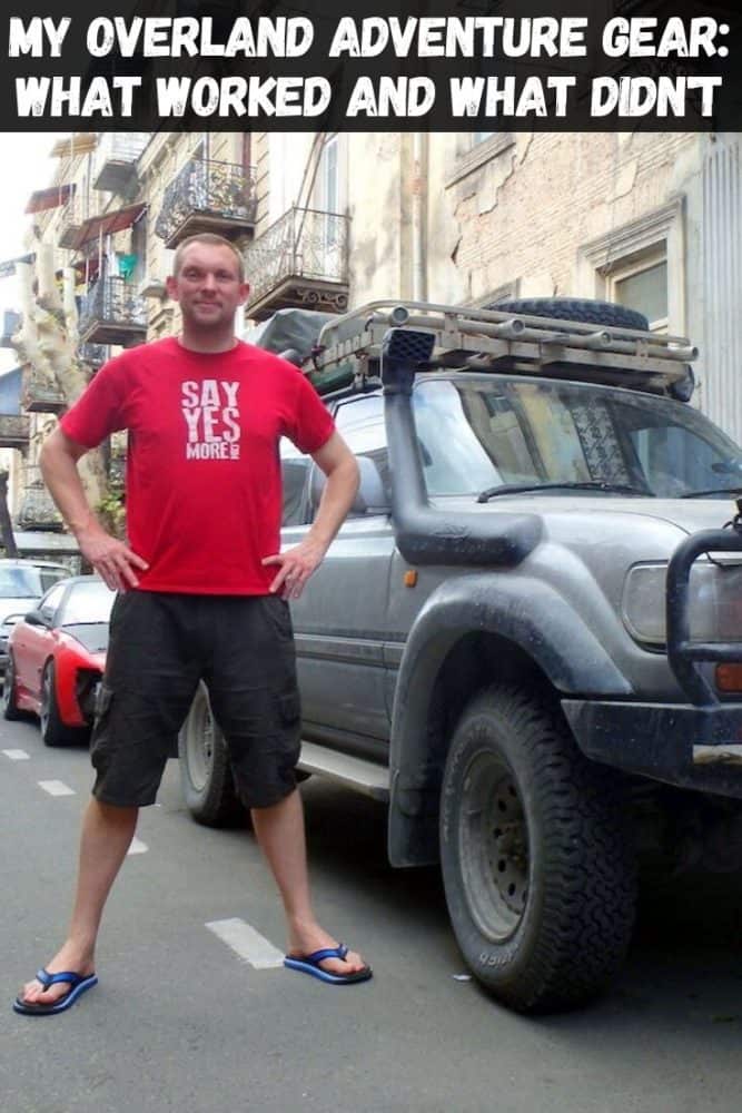
We last heard from Jon as he was starting his overland trip from London to South East Asia and back in Boris, his somewhat-trusty 20-year-old LandCruiser.
Four months later he’s made it to Singapore, and kindly agreed to turn in a trip report on just how everything has gone technology-wise so far. If you’re even vaguely considering an expedition like this yourself, we’d suggest reading this detailed post closely!
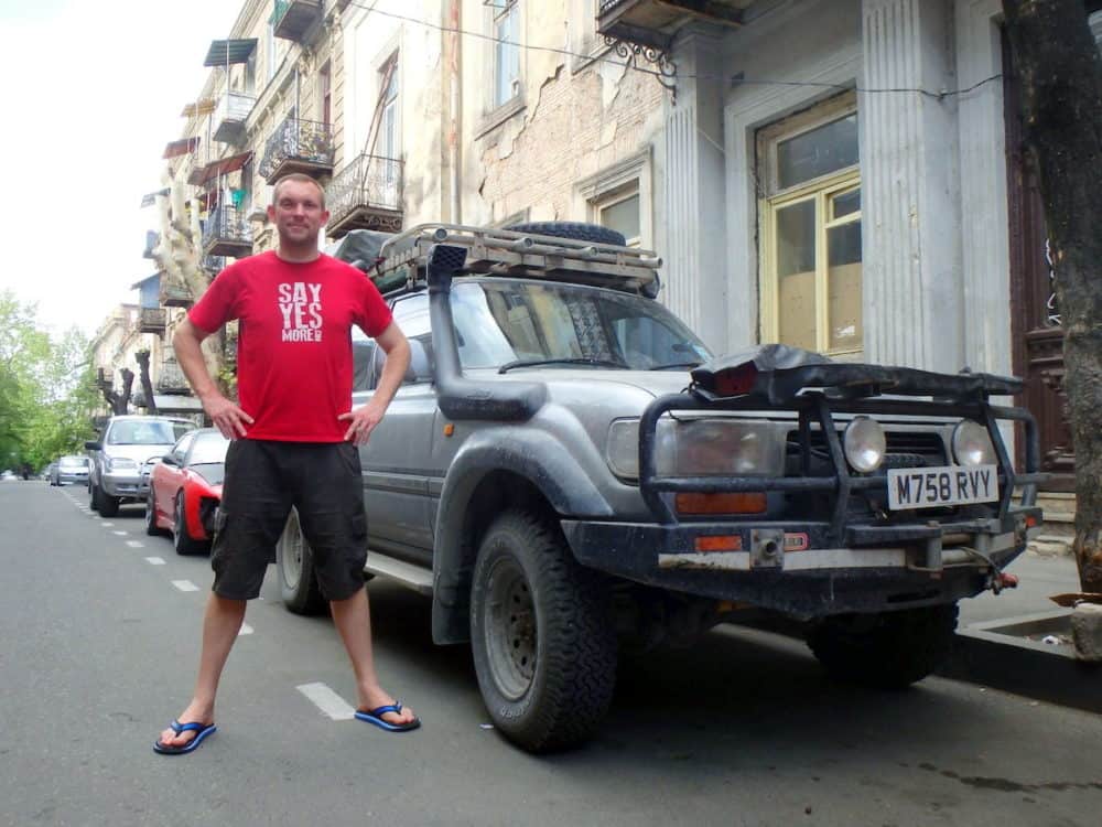
Almost 2 years to the day, after I got up at an ‘Escape the City’ meet-up in London, and asked if ‘anybody fancied going for a drive?’, I find myself in Kuala Lumpur at the end of Leg 3.
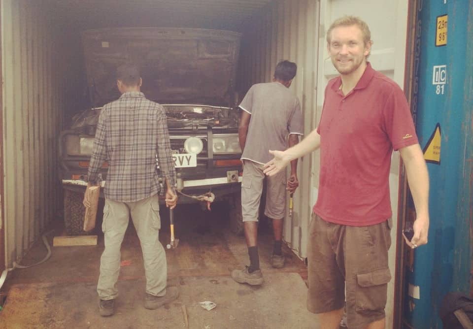
After 126 days on the road, 19 countries, 14,000 miles, 10 Boris (my truck) services, 3 borders crossed without the right paperwork, 2 x-rays, and one dodgy wrist, I’ve reached the halfway mark and the end of my journey east.
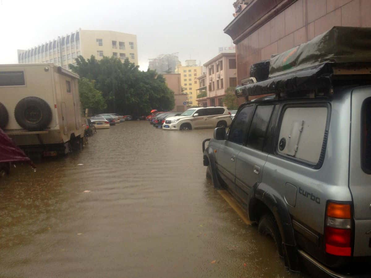
I’ve battled storms, floods, rivers, breaking cars, ‘bike wankers’, delayed ferries, hospitals and ladyboys. I’ve seen deserts, caves, mountains, snow, seas, lakes, and Great Walls.
I’ve drunk vodka with mechanics, farmers, government lawyers, businessmen, salesmen, taxi drivers, hostel owners, students and fellow travellers. I’ve bribed cops, charmed cops, cheered up cops, run away from cops, and nearly run over cops.
I’ve slept in guesthouses, hostels, hotels, roof tents, on couches, on carpets under the stars, and even on the Great Wall.
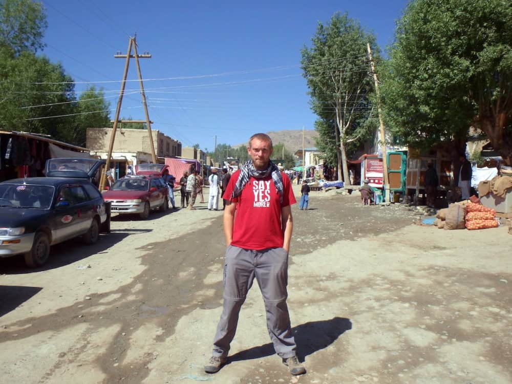
I’ve met local Ukrainians, Russians, Georgians, Azerbaijanis, Turkmen, Uzbeks, Kazakhs, Kirghiz, Tajiks, Persians, Afghans, Wakhi, Chinese Han, Chinese Uyghur, Laotians, Thais, and Malaysians.
I’ve laughed, screamed, yelled, stewed, cursed, fumed, whispered, joked, smiled, and nearly cried. I’ve made many new friends, met some old ones, and lost a few along the way. It’s been quite an adventure so far.
From here I face my toughest challenges yet. In attempting to return home overland to London, I must cross India, Pakistan, Iran (and potentially northern Iraq) to reach Turkey, and the end of Leg 4.
All these countries will prove enormously challenging, India due to its size, Pakistan due to its troubles, and Iran with its new government, not to mention the fact, I don’t have a visa yet.
There may even be the opportunity to pass through the northern Kurdistan region of Iraq. This will be my longest leg yet, somewhere in excess of 100 days. From Turkey it’s just a short jaunt back to London. Easy!!
And finally, I have a treat for you all. With great pleasure, I’d like to show you the first trailer for The Great Game Expedition film. This short film was produced by Joby Newson, my expedition film editor (@Jnewson).
I think you’ll agree he has done a fantastic effort to turn my ramblings into something looking almost semi-professional. Great work Joby!!
The Technology Update
As predicted, of everything I included in my overland adventure packing list, my laptop and iPhone have been the key devices. With these two I’ve been able to do pretty much everything that I needed to do on the journey (except repair my truck).
Boris, my truck has provided a ready power source for all my gadgets and film equipment. This allowed me to camp and be away from power sources for long periods, which would be a bigger challenge for a backpacker.
My universal power adapter has worked everywhere, and my main set of cables have worked a treat. I recommend you carry an Ethernet cable, as Wi-Fi hasn’t made it everywhere yet (I’m thinking of parts of China in particular) but even that won’t be far away.
I’ve not had any use for my spare cables, and I haven’t need to use my spare phone or AAA/AA battery recharger.
Staying connected hasn’t been too difficult either. As long as you have a passport, I’m pretty sure you can get a local SIM card in every country I visited. I didn’t need one in most places so I can’t confirm for sure, but there were places to buy SIM cards everywhere. I will summarise by country below.
Navigation
My old Garmin GPS ceased to be much use after I left Europe. This wasn’t a big problem as Google Maps and Citymaps2go have been all that I’ve needed to navigate with.
As long as you have regular Wi-Fi you can save your destinations in advance on Google Maps, which caches sufficient information to navigate with. In combination with Citymaps2go, as long as I had downloaded the correct areas, I was able to navigate to most locations.
Triposo has been useful on occasion when acting the tourist in town. The massive benefit is that you don’t need an internet connection to use these apps. They work via GPS so you don’t even need a mobile signal.
Beware though, it’s not foolproof. Sometimes Google Maps struggled, especially in the Xinjiang province of China — it wouldn’t work properly at all, making me wonder about government interference.
The Delorme satellite tracker was another option but required too much time to download maps, so I didn’t bother. I had paper maps but mostly used my laptop or iPhone for maps along with my Lonely Planet. I haven’t needed my compass yet.
Communications and Security
My iPhone has done pretty much everything for communications. On the odd occasion it hasn’t, my Delorme satellite tracker has been brilliant for staying in touch when I’m away from an internet connection.
It’s probably the reason why I haven’t brought a SIM card in many places, since I could email, send tweets, and update Facebook from anywhere.
The Delorme has also created my live route map around the world and recorded my route in extreme detail. Every 10 minutes it can send my location, provided I have a clear view of a satellite.
Fortunately I haven’t had to use the emergency SOS button yet, and my Iridium satellite phone hasn’t been required either. It will probably only be needed in an emergency, which makes it an expensive accessory for this trip but provides peace of mind. If I wasn’t going to a number of the world’s current hotspots, I probably wouldn’t have brought it along.
Software Security
My Witopia VPN has been a great asset. In a number of places in Central Asia I’ve been able to get around the country’s restrictions. China was the most restricted country, but I had no problems once the VPN was activated.
YouTube was blocked in Tajikistan (because the president didn’t like a video of his family being posted), and WordPress was blocked in Uzbekistan. The VPN solved these access restrictions.
Unfortunately I didn’t get to test it in Turkmenistan, because the internet could only be found in special cafes, and Wi-Fi in expensive hotels. I wasn’t there for long so I didn’t try. You don’t have to use Witopia as other VPNs will also work, but I’ve been happy with it.
Social Media Channels
All my social media channels have worked as planned, although in some countries I needed to enable the VPN first to get around local restrictions.
I found that the Buffer app on my iPhone allowed me to get around the Chinese restrictions on posting to Twitter and Facebook. I guess the authorities haven’t caught onto that yet, which means that other small apps might just work as well.
Social Media Tools (Apps)
Hootsuite, Buffer, and IFTTT have all worked as planned. They have allowed me to post to my Twitter and Facebook accounts, and to schedule these posts when required.
Travel Apps (for iPhone)
Of all the apps, Google Maps, Citymaps2go and XE Currency have been brilliant. Triposo, Google Translate, Hostelworld, Hostelbookers, and Couchsurfing have been more than useful.
I’ve even used the Direct U Russia and Asia maps and compass occasionally. Onavo Extend, Red Cross, Wifi Finder and the language guides haven’t been required, and I could probably survive without them.
Internet Connectivity
Through a combination of couch surfing hosts, hostels, hotels, cafe Wi-Fi and my Delorme satellite tracker, I didn’t buy a SIM card until I got to Kyrgyzstan. Even that was only when I brought a cheap card and modem from another traveller. It was useful, but I could have survived without it.
I just wasn’t in places long enough to warrant buying one, when I could access the internet from the places I stayed or ate at. That said, it was pretty cheap and easy to buy a SIM card in most countries as long as you had a passport.
Non-Technical Aids
My maps have been useful for discussing plans with others. Mostly I used them in conjunction with my dodgy language and charade skills to show the locals where I’d come from and where I was going.
The Lonely Planet guidebooks were very helpful as was the Russian language guidebook. I kept forgetting about my Point-it picture book, so I didn’t get the best use from that.
Country Reports
Get regular updates from the world of travel tech and remote work
News, reviews, recommendations and more, from here and around the web
Summary
As I’d hoped, Central Asia is pretty well connected for the traveler. However it’s far from perfect, and the connection speeds are often slow. Wi-Fi is available in most places, especially those where travelers are common. Purchasing SIM cards only requires a passport and typically takes ten minutes to set up.
The stores are filled with young people who quite often speak English and can help you work out what the best deal is for you. If that fails, you can get by with sign language.
The availability of internet connections along with the tech tools I’ve taken have been of immense help to me as a solo traveler. It has allowed me to deal with problems immediately and make changes to plans on the spot. For a traveler that likes to keep his options open, with as much flexibility as possible, it’s been a godsend.
Here’s to technology continuing to play a successful role in my expedition on the return leg to London!!