
10 of the Best Hiking Apps to Download Before You Hit the Trail
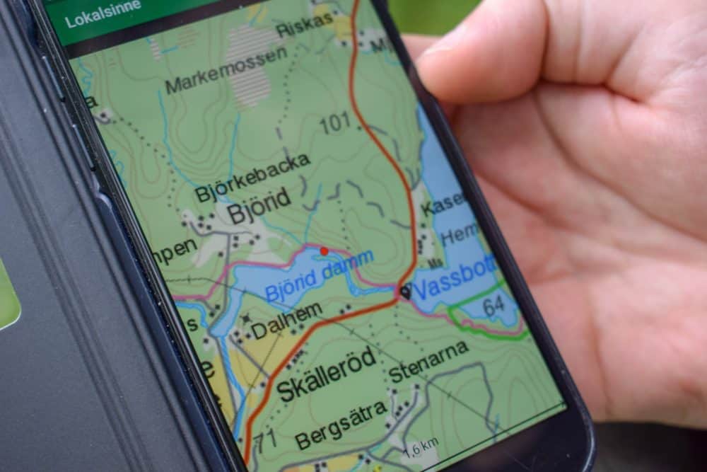
Looking for a trail map that fits in your pocket, or detailed information about an area you’ll be hiking through? Want to know all about a stunning mountain peak, or gorgeous field of flowers?
What about if something goes wrong and you need to notify loved ones, survive in the wilderness, or simply find out where the nearest cell signal is?
There’s a hiking app out there for all of those situations, and plenty more. In fact, there are so many available that after testing a whole bunch of them, I could only include a few of the best ones in this article.
So, without further ado, these are the most useful, interesting, and exciting hiking apps for the adventurer in all of us.
Maps & Trail Information
AllTrails
AllTrails is probably the most popular hiking app out there, providing maps, reviews, and details for over 100,000 hand-curated trails around the world.
Some countries have extensive trail coverage, such as the United States, Mexico, and France, while others like the Philippines and Argentina have more limited details. Either way, AllTrails still has the most global information overall, and it’s growing all the time.
With the free version, you can search for trails and view maps both online and offline. Category filters like dog-, kid-, or wheelchair-friendly are easily available, and you can record hiking statistics like total distance, elevation, and moving time.
If you pay for AllTrails+, you remove the ads and get access to several other features. The most important for me is the ability to download trails and maps for offline use. When you’re in the middle of nowhere, it makes a big difference. You can also print maps out, get alerts when you take a wrong turn, and more.
With the demise of ViewRanger (R.I.P.), this is the hiking app I now use most often. It’s got me out of a jam more often than I care to admit.
iOS and Android; free, or AllTrails+ (free for a week, then $29.99/year)
FATMAP
A new-ish player on the scene, FATMAP is already getting a lot of attention. Recently called “Google Earth on steroids” by Outside Magazine, it’s the favored app of some well-known mountaineers and skiers.
FATMAP has detailed 3D maps for skiing, hiking, and biking, developed from satellite imagery and overlayed with terrain, sport, and resort information. You can also switch between summer and winter imagery, receive avalanche bulletins, and get special skier-specific data like which lifts are open.
The app is currently available in English and French.
iOS and Android; free, or premium membership for $29.99/year
Hiking Project
My favorite aspect of Hiking Project is its focus on community-driven content. Users are encouraged to share their adventures, submitting information about a trail, hike, or point of interest. It’s reviewed by an in-house team and, if all goes well, the details are added to the app.
Produced by REI Co-op, it’s an ad-free project that’s often compared to a guidebook. You’ll find rich descriptions of trails, accompanied by images of lakes, leaves, and perilous cliffs. You may want to check out other REI apps such as the Guide to National Parks as well.
iOS and Android, free
Gaia GPS
The Gaia GPS app can serve many purposes, but is particularly popular with hikers in Canada, historic map enthusiasts, first responders, and fans of 4×4/off-road trails. The free version provides access to topographic and satellite maps.
The premium version adds offline downloads, historic topo maps, illustrated trail maps from National Geographic, US hunting maps (including information on property boundaries), and expanded European maps.
iOS and Android, free, or $39.99/year
Guthook Guides
The darling of the US thru-hiking community, Guthook Guides tends to be the app of choice on long-distance hikes like the Pacific Crest and Appalachian Trails, plus many shorter regional trails.
It also covers many other popular routes around the world, including the Camino de Santiago, Te Araroa in New Zealand, and the West Highland Way in the UK.
Working fully offline, you’ll get detailed trail information and waypoints, elevation profiles, and GPS position tracking to show where you are and help you find your way when the trail disappears.
Water sources, campsites, viewpoints, and more are all included, along with nearby towns and resupply points. There’s also a social feature that lets you check in and leave updates for friends, family, and anyone else interested in tracking your progress.
iOS and Android, free. Guides priced individually.
Specialized Features

Ramblr
For bloggers and social media mavens, Ramblr provides a unique opportunity: a blogging space and hiking app rolled into one.
Users are encouraged to create a virtual journal where they can blog to their heart’s delight about their outdoor adventures. Photographs, GPS points, and useful pieces of data are all included on a map.
These entries are shared with the wider Ramblr community, and you can take the HTML code from your journey entry to use on your personal blog or website.
iOS and Android, free
Spyglass
The idea behind Spyglass is simple (it’s a compass!), but the execution is advanced. You get access to a high-tech compass and GPS navigator, with pretty much any feature you could hope for.
What features, you ask? There’s “[…] a milspec compass, gyrocompass, maps, tactical GPS, waypoint tracker, speedometer, altimeter, gyro horizon, sniper’s rangefinder” and many more.
iOS ($5.99) and Android, free with paid extras
Peakfinder
With Peakfinder, it’s all about the mountains. The app provides detailed information for 350,000 peaks around the world, “[…] from Mount Everest to the little hill around the corner.”
You can get 360° panoramic views from any viewpoint of your choice, overlay images from your own camera with mountain views, and use the telegraph feature to identify less-prominent mountains in a given area.
The data is drawn primarily from OpenStreetMap, a free data project, but Peakfinder provides a curated, feature-rich experience.
iOS and Android, $4.99
iNaturalist
Want to hike while feeling like a useful human? Check out iNaturalist.
When you’re on a hike and encounter something interesting (maybe a funky mushroom or an unknown tree), simply snap a photo with the app. Write up a description, include the location, and then share the information with the community.
From there, your observations will be shared with scientific data repositories such as the Global Biodiversity Information Facility, as well as the general iNaturalist community. In other words, you can hike and contribute to scientific research.
If you don’t know what you see on your hike, experts can even help you identify your find. iNaturalist is a joint collaboration between the National Geographic Society and California Academy of Sciences.
iOS and Android, free
Get regular updates from the world of travel tech and remote work
News, reviews, recommendations and more, from here and around the web
Safety & Survival
Cairn
Simply put, Cairn is a hiking safety app. You can share your real-time location and status updates, but that’s just the beginning.
You can also get crowdsourced information for a given area (like where people have found cell phone coverage), access offline maps and trails, and be informed when you enter areas with phone coverage.
iOS, free, or Premium (60-day free trial, then $4.99/month or $26.99/year)
Which hiking apps do you find helpful? Share your experiences in the comments!
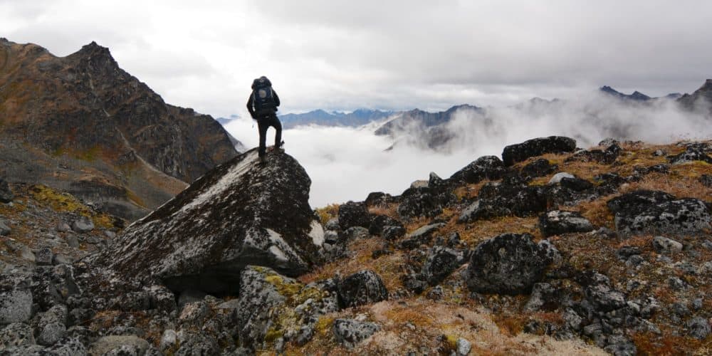
Images via PIXNIO (female hiker beside lake), Daniel Johansson (forest trail on GPS), MaxPixel (female hiker in the Alps), and Paxson Woelber (male hiker in the mountains)


Great info! Thanks!
I’d love to see info on Guthook, which seems to be the darling of the thru-hiking community? It provides detailed information about the trail as well as showing where you are on it with a GPS-like accuracy. (I think using satellites–you don’t need wifi) Each trail map is purchased separately.
Mapy.cz (free) – app/online desktop versions – plan your routes, save them to your account online, figure out distances & elevations of your hiking route, find yourself with GPS, plots you on the trail, find your way back, can use offline by downloading regions from all over the world, oh and did I mention it’s free?
Love the Cairn app not just for safety but their offline maps and navigation ETA. Thanks for including this.
AllTrails is $29.99 a year, not month.
Thanks for spotting that – fixed!
I was looking for something that tracks hikes recorded so i can have a map of all our hiking history. I saw Strava, which is designed to track distance and time walked, and it does record on a GPS map for distance. Anything else do that?
Jeff, central PA
Viewranger can definitely do that as well, as I’ve used it that way. It can even generate a fancy 3D view of your route afterward!
Hiiker app should be on this list! Really great for long-distance trails.
Viewranger taken over by outdooractive with mixed results
but a monthly sub so more chance to test and jettison if not suitable.
In the UK the OS do their own app using their excellent maps and a free 7 day trial.
LocusMap, Green Tracks or Komoot might be worth a look.